• '18 '17 '16

    Map 1941, triple border, 1129x600mm

    • seazone and territory border topology checked again
    • background graphic adapted
    • all other mentioned items corrected/improved

    Hopefully final version:
    http://www.mediafire.com/view/ue900080s5x1xa8/1941-triple_border_1129x_600mm.pdf


  • Fantastic job Dedo, a thousand thanks. I wish there would be more people to check the versions though…

  • '18 '17 '16

    You are welcome, Sir, I’m most grateful for your help on the maps!
    With the utmost probability there are no more errors. Everything is checked several times.


  • I will certainly have the 1317 x 700 mm printed, it is perfect.
    Will upload some photos of the thing on my table asap.  :-)


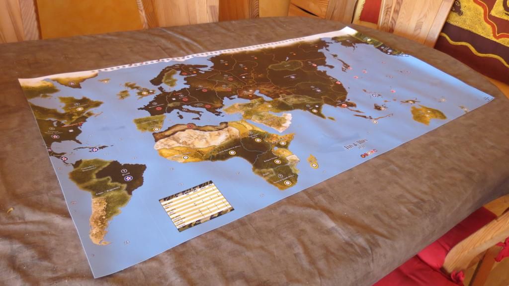
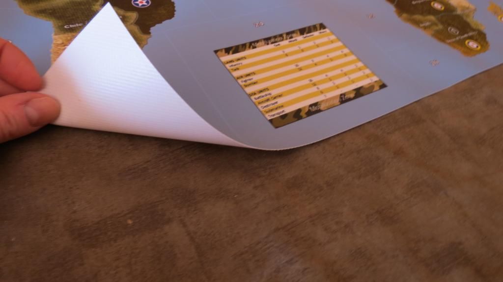
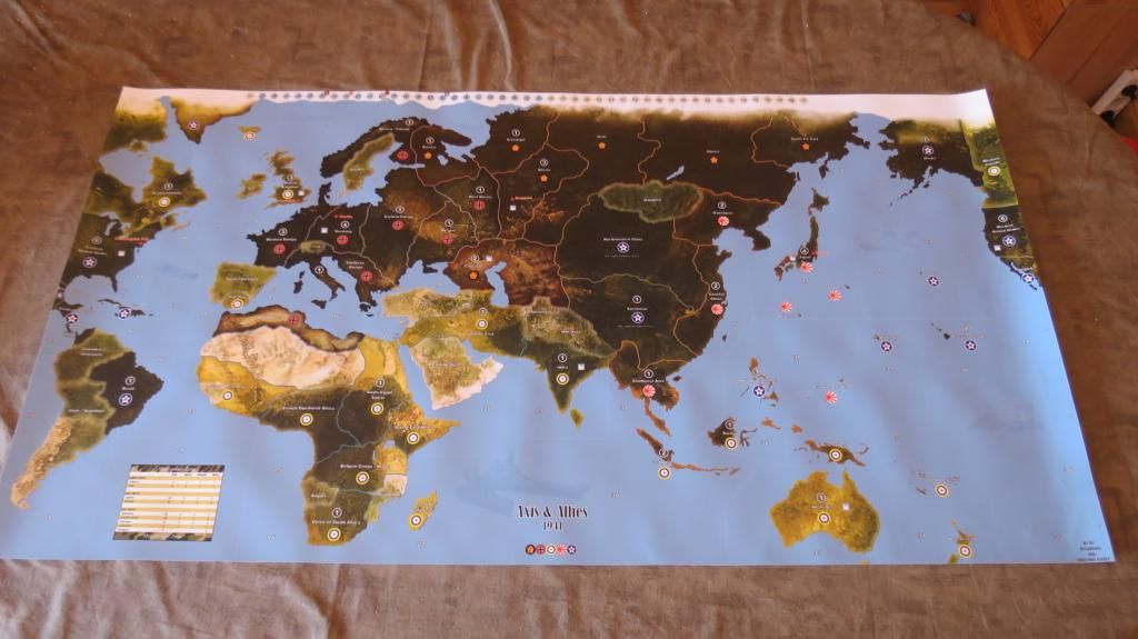
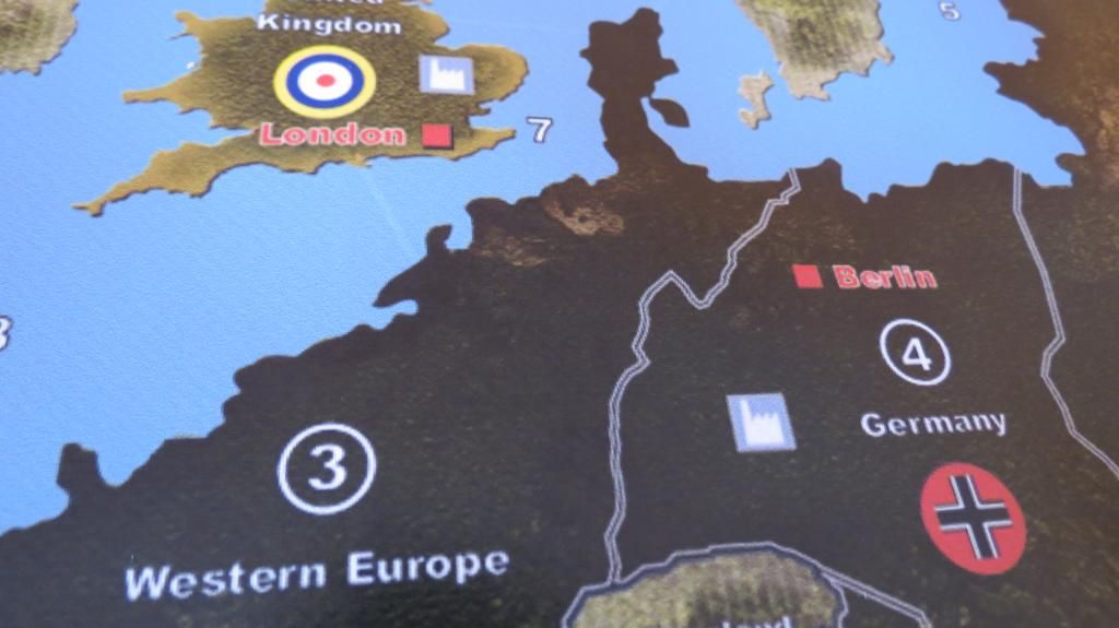
  • Done, here are the photos :

    Printed on 450gr anti-fire stuff

    To be honest, i’m happy but just a bit disapointed cos it’s not completely clean, it’s a little blurry, i don’t know if it’s because the initial format is 600 ?

    Thanks again Dedo !!!  :-)

  • '18 '17 '16

    Hm, the map you printed looks indeed a little bit grainy and streaky (…whereas I’m unable to determine to what extend this is due to the quality of the photo…). To check the PDF-file, I printed it out with a laser printer on paper. My print out is perfect, even better than the PC-view of the PDF-file what is not astonishing to me: the map PDF-File itself has got a resolution of 2400 dpi, thats quite a lot and more than enough for a very detailled print out. I assume, the print shop is the problem here. Sometimes they are not able to print in such a high resolution, a second problem may be the material of the printing surface, they used. What can be done? You should print out a proof copy on paper for yourself (not the whole file but one page of a “poster”, that is, a part of the map, where all details of the map style can be seen). Then you should ask your prefered copy shop to make a small proof copy before printing the whole map (optimally, they print the same page/part of the poster). Compare und judge whether the print out of the copy shop fits your requirements or not.

    By the way, the initial format of the map isn’t 600(mm?), but 1620mmx860mm and, eventually, the map was reduced to smaller sizes.
    A reducement of size would never lead to a decrement of quality of the graphics, its even vice versa, mostly you improve the quality.
    Only enlargements of sizes could be critical. For instance, if you try to enlarge a bitmap, the quality of the bitmap wil be decreased: the same information of the graphic (number of pixels) is now shared in a larger area, that is, “stairways” result and make the bitmap clumsy. This happens only to raster graphics/bitmaps but not to vector graphics. All elements of the map (lines, curves, captions) with the exception of the map istelf ARE vector graphics.

    In other words, the reduction from full size to the smaller sizes is irrelevant to the quality due to the principle of vectorizing, that is, proportionaltity and quality of the graphics remain.

  • '18 '17 '16

    it’s a little blurry, i don’t know if it’s because the initial format is 600

    Did I get this right, or in other words, could it be, that you took the smaller size of the map (600mm x…), gave it to the copy shop and ordered a bigger one (700mm x…) for a print out?


  • It isn’t the photo, but i think the printing society did a bad work on it i think. I will be able to compare with the 1942 map as i changed the printing society. I will receive the map on wednesday, will upload some photos to compare.


  • Hi Orillian,

    Are you really sharing your map file? I thought we could only by the printed enlarged version.

    If youre saying that we can have it, then I want it Otherwise, sorry for asking…

  • '18 '17 '16

    Hi Orillian

    Who is Orillian?

    Are you really sharing your map file

    That’s the use of this thread.

    I thought we could only by the printed enlarged version

    What do you mean by “by” (buy?)? There’s nothing to buy, the files are for free.


  • Hi dedo

    First can I say thanks for all your hard work on this. The result looks great.

    I am intending to get the 1129x600mm version printed and note that BananeDC used “450gr anti-fire stuff”. Obviously I would ask the printer’s advice but wondered whether you had a recommendation?

    Thanks again.

    Cheers
    PP

  • '18 '17 '16

    Thank you for giving kudos to me!

    I take so called Blockout Banner (760gr/qm) or PVC Banner (510gr/qm) with antiglare. Both can be printed with a solution of 720 dpi, inks should be a mild or eco solvent.

    It is important to take heavy ware (a lot of gr/qm). This kind of quality lays perfectly on a table and could be furled easily by avoiding folds.


  • Thanks very much for the advice dedo.

    Cheers

    PP


  • Can anyone recommend or suggest a venue for printing this. I went into my local office max who has printing services and they looked at me like I have two heads…


  • My brother printed 3 maps for myself and friends in the UK. He has his own small print business, but actually sourced them from Italy.

    Where are you?


  • Ah, alas, I am state side. New York area to be exact. Any other ideas?

  • '18 '17 '16

    Unfortunately, I can’t recommend a special shop because I’m from Germany but instead I recommend you to do an internet search with the following search terms:
    canvas printing, vinyl banner printing, eco solvent printing, New York


  • Thanks. I appreciate the advice, I will begin my hunt…

  • '17 '16

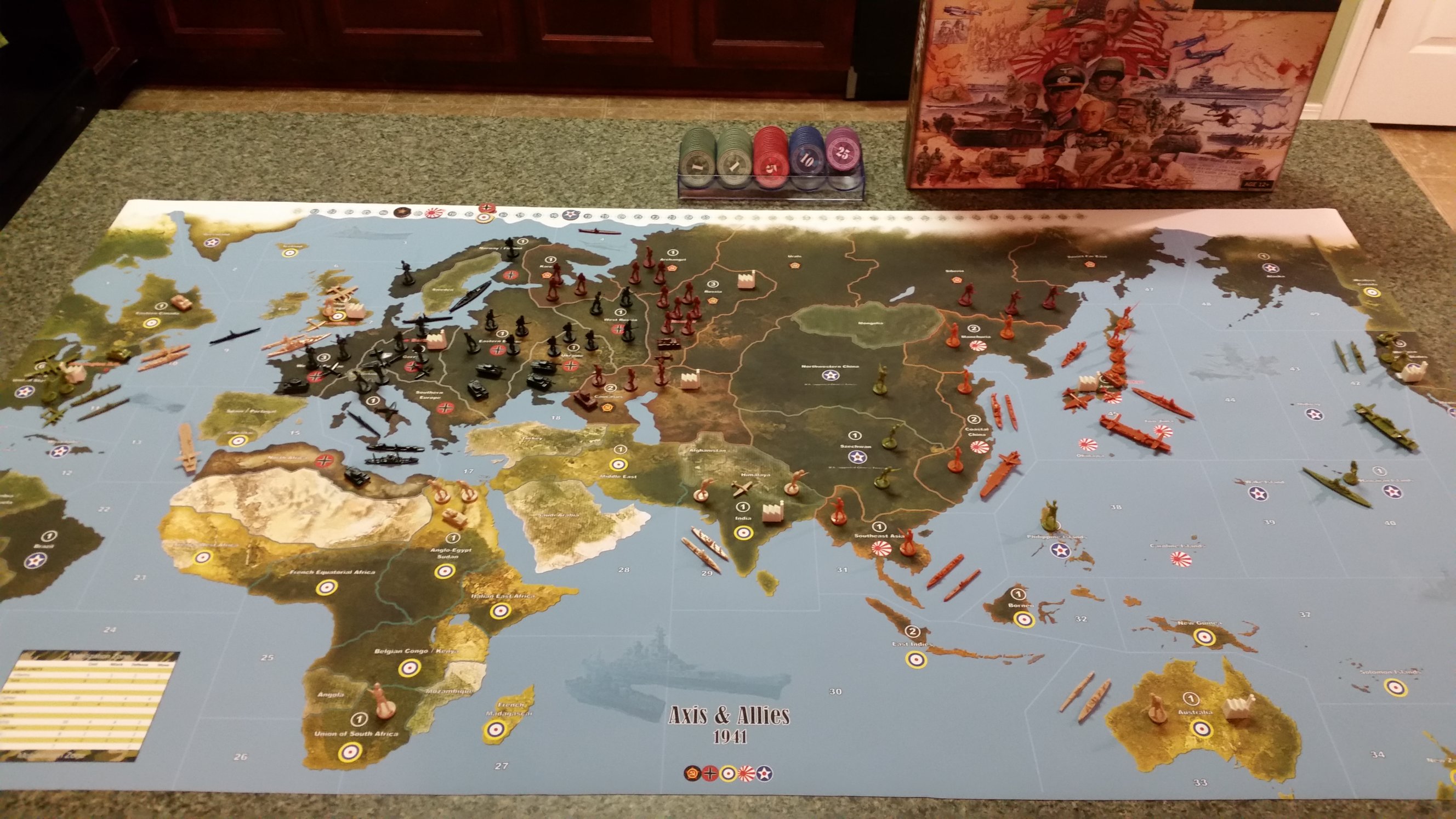
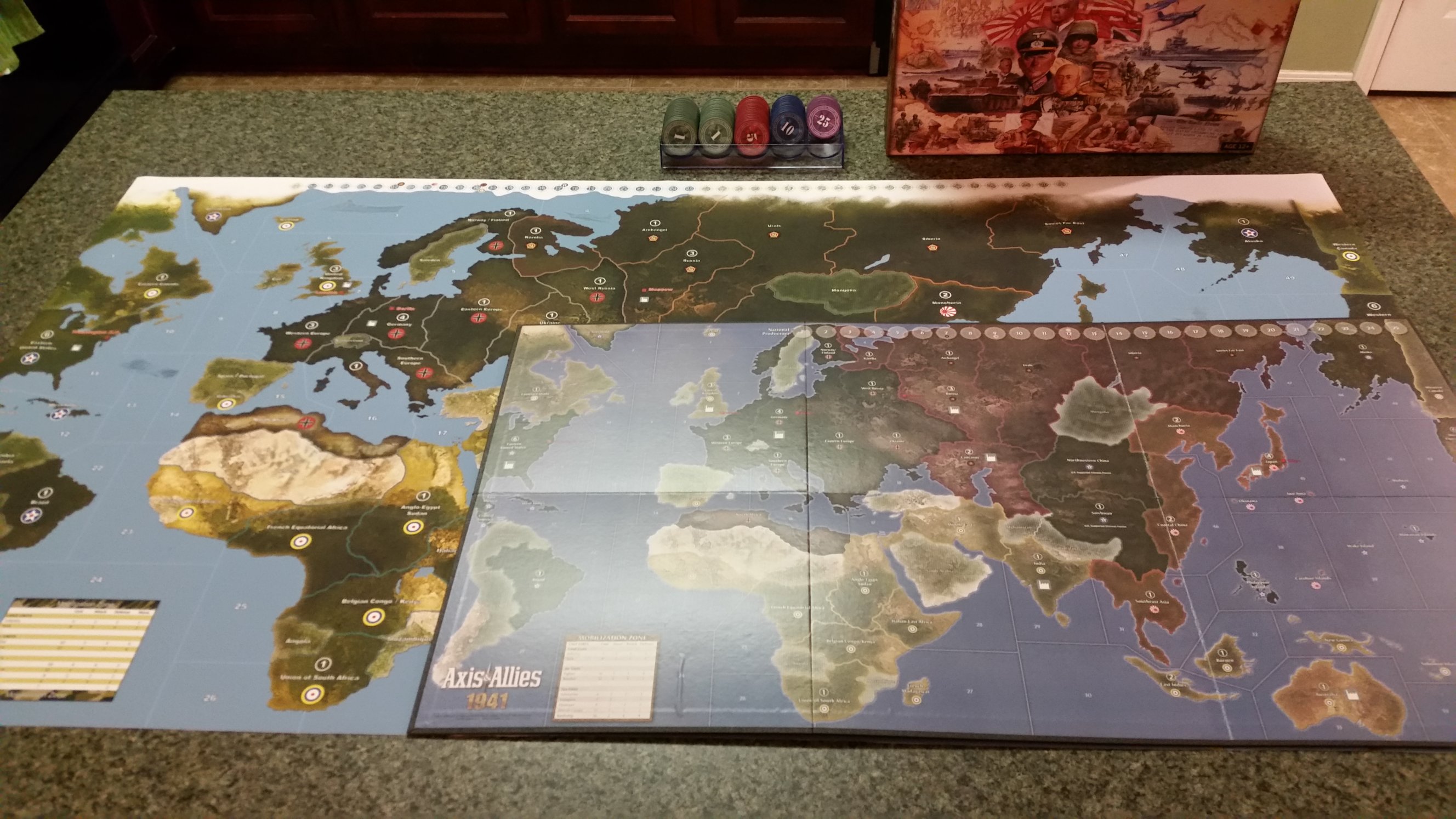
    Just as a public service, I had the 1941 Supreme map (1329x700mm, or 52x28") printed at my local Fed-Ex Office print shop on outdoor banner vinyl.  It cost me about $70 (US dollars) to have this done.  I know not everyone will get the same prices or print the same size, but that’s just to give a ball park figure in 2016 dollars of what a typical big box print shop will charge for such a project. Kudos to Dedo for making this available to the A&A community! Two pics below include one shot ready to play, and another showing the size difference between the printed map and the original board map. Here’s my results:

    my1941custommap1.jpg
    my1941custommap2.jpg

  • PantherP Panther locked this topic on

Suggested Topics

  • 12
  • 18
  • 3
  • 20
  • 11
  • 2
  • 1
  • 1
Axis & Allies Boardgaming Custom Painted Miniatures

37

Online

17.4k

Users

39.9k

Topics

1.7m

Posts