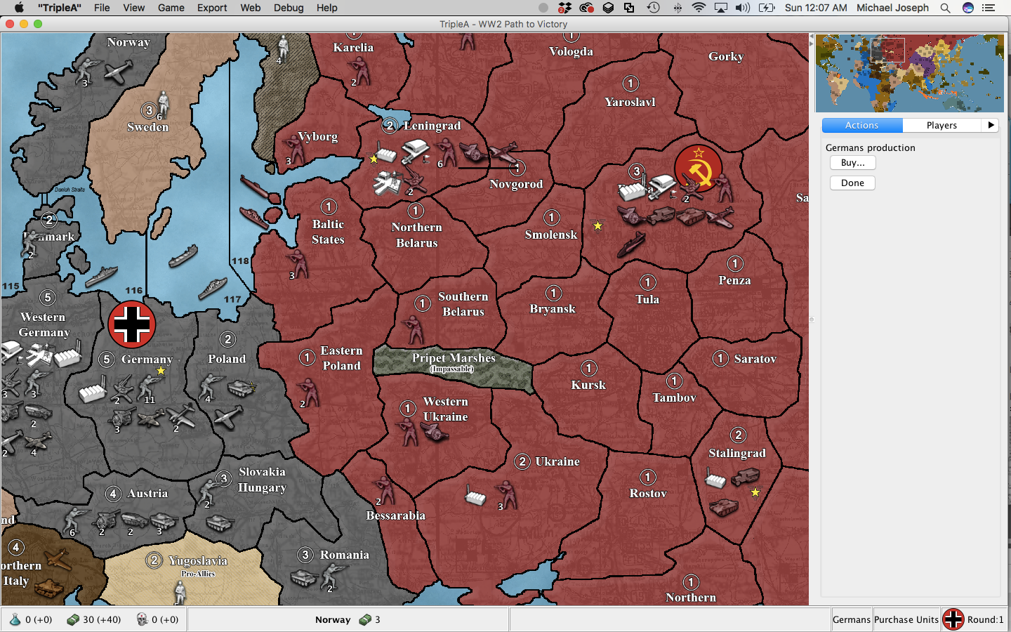
@farmboy The redrawing of Russia was informed by three main goals: (1) to foster a more dynamic Russian front than simply retreating and advancing two huge stacks; (2) to force Germany to choose between competing strategic objectives, rather than accessing all of them at once; (3) to more accurately reflect geographic realities.
On the first goal, Adam and I agreed from the outset that western Russia needed more territories. We used natural obstacles–namely, the repositioned Lake Ladoga and the enlarged Pripet Marshes–to give Russia more cover for counter offensives, and to give Germany more opportunities for flanking.
On the second goal, we were careful to make sure that a stack of fast German units poised to strike Moscow could not also be in range of every other strategic objective in Russia–i.e., we wanted to avoid the Bryansk/Rostov situation from G40, where Germany basically commands the entire arena from one or two territories.
Finally, on the third goal, it always bothered me personally that Moscow and Stalingrad, in G40, are the same distances from Berlin regardless of which route you take to get there. Geography dictates that If Germany goes south (i.e., under the Pripet marshes), it should take less time to get to Stalingrad and more time to get to Moscow. Conversely, if Germany goes north, it should take more time to get to Stalingrad and less time to get to Moscow. Finally, Moscow shouldn’t be closer to Stalingrad than it is to Leningrad, because in real life, Stalingrad is about half again as far from Moscow.
These considerations are now reflected in the new Russian layout. Germany can reach Stalingrad in six moves, but only it it goes south. Germany can reach Moscow in six months, but only if it goes north. In other words, Germany must choose. This was the goal.


