• The SZ to the left of France on your map should be split in two. There is a number to the right of the Italian/Soviet sub.

  • Customizer

    @calvinhobbesliker:

    The SZ to the left of France on your map should be split in two. There is a number to the right of the Italian/Soviet sub.

    You are correct. The map has been updated on the first page. Thanks.

    Also i just noticed that i forgot to add two other sea zones in between USA and England. It should be four spaces to england from USA. That means that fighters cannot fly directly to england in one turn from USA. I guess that means that fighters will land it Iceland?

    I’ll update the fix this weekend. Let me know of any other mistakes you guys find.


  • Map looks pretty close. Good job.


  • @Bob_A_Mickelson:

    @calvinhobbesliker:

    The SZ to the left of France on your map should be split in two. There is a number to the right of the Italian/Soviet sub.

    You are correct. The map has been updated on the first page. Thanks.

    Also i just noticed that i forgot to add two other sea zones in between USA and England. It should be four spaces to england from USA. That means that fighters cannot fly directly to england in one turn from USA. I guess that means that fighters will land it Iceland?

    I’ll update the fix this weekend. Let me know of any other mistakes you guys find.

    England is 5 spaces from EUS on your map.

  • Customizer

    Updated map to correct sea zones between Canada and England. (See first entry on thread.)

    Enjoy.


  • Bob, do you think you can make a similar map joining the Pacific and Europe maps?


  • holy crud, Russia is huge  :-o

  • Customizer

    @cminke:

    by the way bob r u going to do a nother set of charts for g40

    Thats the plan, though I can’t guarantee ill get it done fast. I will likely take some time. I’m not a computer graphics guy so it takes quite alot of time for me to figure out how to make stuff look good. I did the AAP40 Charts in powerpoint since I didn’t own photoshop. For clarity sake. I’m planning on making both AAE40 and AAG40 charts.

    @calvinhobbesliker:

    Bob, do you think you can make a similar map joining the Pacific and Europe maps?

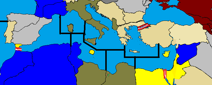
    I’m not planning on doing that at this time. Frankly the Russian territories are quite hard to make out and accurately combining the maps may prove difficult. I have considered putting in some IPC values in territories that can easily be seen. Larry has also announced how many IPCs some of the powers are going to receive. France gets 17 in AAE for example. But I’m dreading looking up all that information on Larry’s site. It will be quite time consuming for just a few more morsels of information. We’ll probably get a high resolution map photo at GenCon anyway. So I’m not convinced that the effort will be worth it.


  • When is GenCon?


  • Since the Gibraltar is now a strait you cant have it that way. Look a closer to my map suggestion under, how the seaborders need to be drawn, man.

    med.PNG

  • Customizer

    I hope your right and the Mediterranean is arranged the way you drew it razor. Unfortunately I drew what I could see and frankly I don’t see what you drew when I look at the blurry map. Time will tell how accurate my translation of the blurry map will be. Hopefully I’ll be in the neighborhood of 90% correct. Again I hope that you are correct, as it should make for more interesting game play.


  • The baltic sea is supposed to have 3 sea sonez according to LH


  • A few noteworthy changes that I susspect are true.

    A 2nd egyptian territory, Alexandria/Tobruk
    Reorganiazed sea zones around the UK, Unified English Channel and 2 sea zones accesable from the Denmark sea zone. (It would be unfair to susspect the Allies could shut the germans in at both the Denmark SZ and North Sea SZ)
    Some adjustments in Russia

    And I saved it as Jpg, oops

    map.JPG


  • The UK has only 2 SZ around it?


  • ok….maybe im wrong, the Channel might need to be split and the liverpool area made a seperate SZ.

    3 zones i what it should display. but there should be 2 ways out of the denmark SZ so german subs are a real threat.


  • bump so I can find it easier instead of having to look through previous pages.

    Is it possible to have this stickied for reference when discussing the Europe 1940 map?


  • @SAS:

    bump so I can find it easier instead of having to look through previous pages.

    Is it possible to have this stickied for reference when discussing the Europe 1940 map?

    Bump

    And I second the motion for stickiness.

    #659


  • Question…after France falls will British and American naval units be allowed to enter the Med via Gibraltar? Now that Gibraltar is a strait…


  • @mike:

    Question…after France falls will British and American naval units be allowed to enter the Med via Gibraltar? Now that Gibraltar is a strait…

    why does this question keep comming up? nothing happens after mainland France falls that would prohibit ship movment. Gibraltar is British tt, and as the area in question is referred to as the Straits of Gibralter, I would assume that in order to close this area you would need to control said tt. Therefore, after France falls, nothing should happen to allied access to the Med.


  • The question comes up because the opposite side of the GIB straits is a French colony.

    #668

Suggested Topics

  • 3
  • 4
  • 6
  • 18
  • 21
  • 3
  • 93
  • 57
Axis & Allies Boardgaming Custom Painted Miniatures

80

Online

17.2k

Users

39.5k

Topics

1.7m

Posts