@Imperious-Leader The center of the map (Antartica) could maybe also used for additional gameboards etc. But to be honest, I will first proof the board when printed. Not sure if I will get dizzy when playing with it…😉
Posts made by Lompestein
-
RE: Azimuthal Equidistant G40 mapposted in Customizations
-
RE: Azimuthal Equidistant G40 mapposted in Customizations
Thx man, that’s a fine piece of work. I’m intrigued with this map.
Also thanks fot sharing the .xcf file. (more people should do that) I felt free to play around with it and add some more layers for beter control of the colors and display of the final output image.
I will print it and check how the playing experience is. When that’s ok, maybe I will add some overlays in it, see also my customized map for global: https://www.axisandallies.org/forums/topic/40086/jj-s-axis-allies-global-detailed-map-file-for-large-scale-printingHave you printed and play with it yourself?
Another question; how did you transform the map in GIMP?
Here is were I share all the files:
[Download][link text]((https://drive.google.com/drive/folders/1qGlOXyLRZ3u1aW7G4wFaux3P8IeZIlkm?usp=sharing)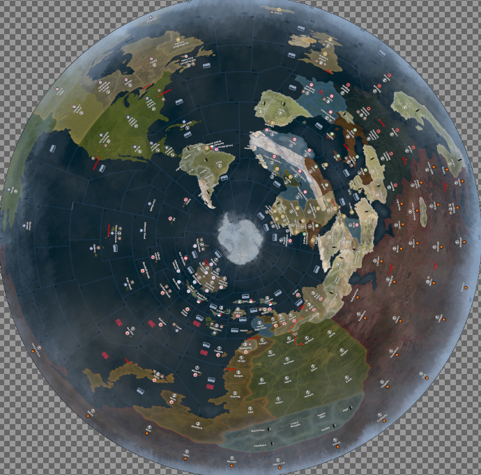
-
Axis & Allies Global Azimuthal Equidistant map JJposted in Customizations
Not printed yet, but I’m intrigued with this map which was originally created by Demaris: (https://www.axisandallies.org/forums/topic/33023/azimuthal-equidistant-g40-map)
I just add more layers to custumize it.
I’m curious if this gives a good playing experience, when it is I may put some overlays in it for more playing fun.Download; https://drive.google.com/drive/folders/1qGlOXyLRZ3u1aW7G4wFaux3P8IeZIlkm?usp=drive_link
(GIMP source file also available)
-
RE: JJ's Axis & Allies Global (detailed) custom map file (for large scale printing) + GIMP brushesposted in Customizations
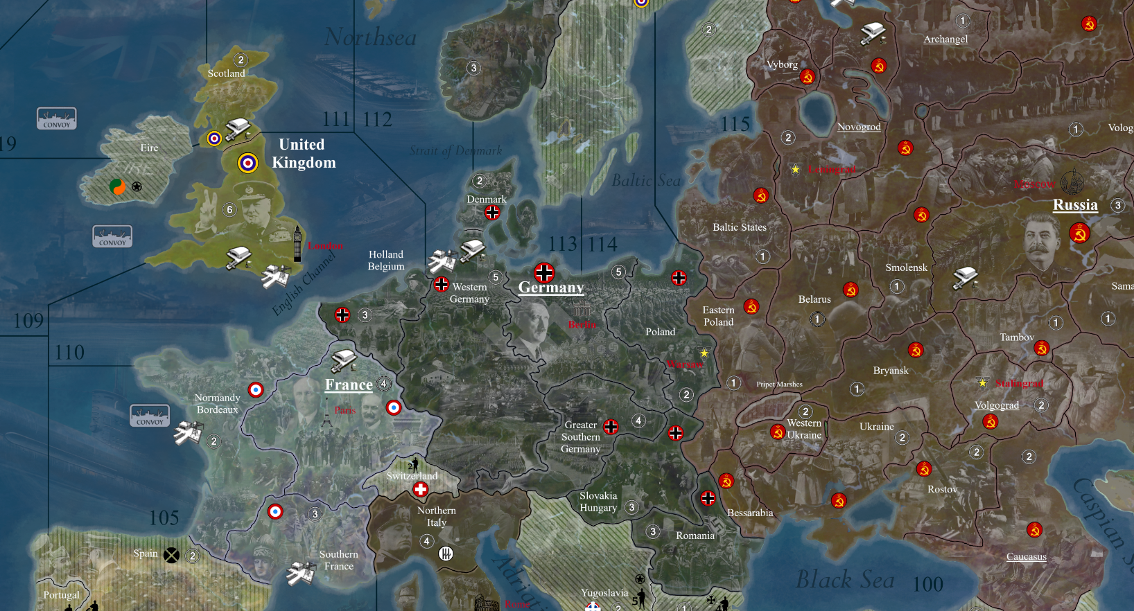
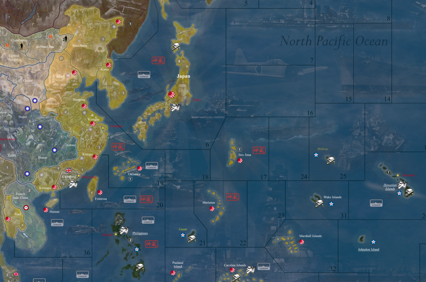
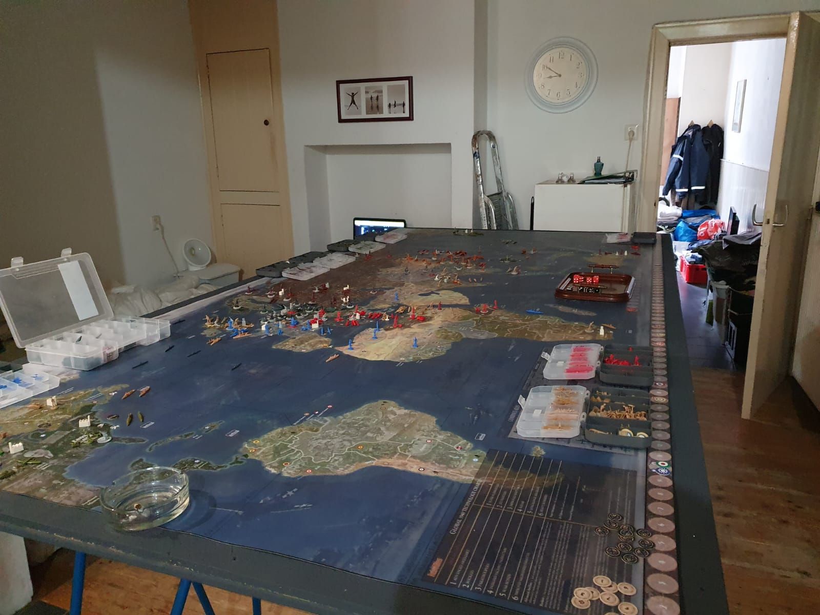
Today received the print (1350x2730 mm) I’m prety satisfied with it :) :
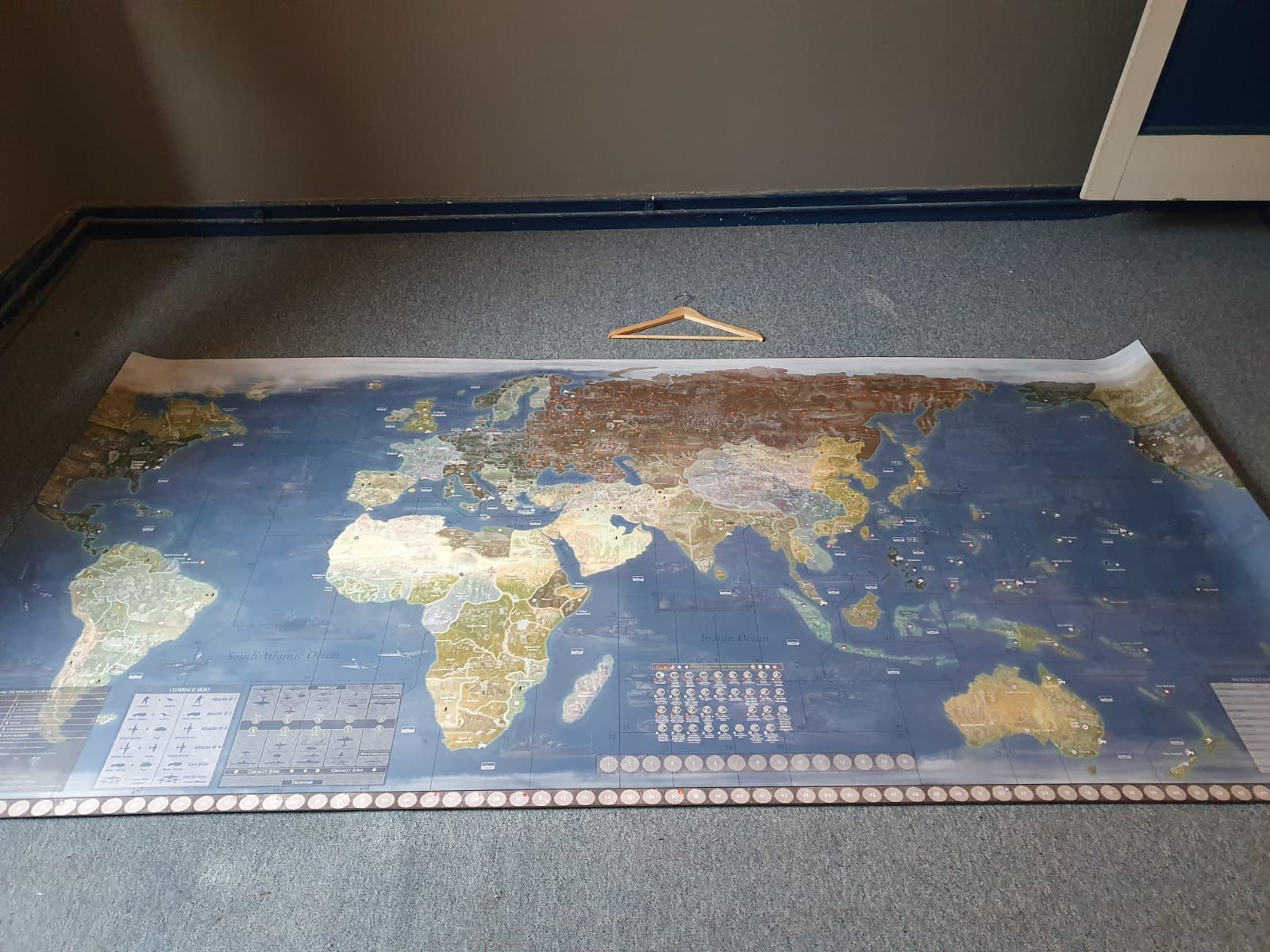
Ready to rumble…
-
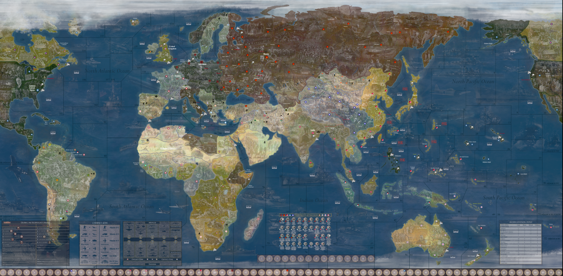
JJ's Axis & Allies Global (detailed) custom map file (for large scale printing) + GIMP brushesposted in Customizations
Inspired by the beautiful maps that can be found on the internet, I decided to teach myself GIMP and make a map for A&A Global myself. It contains many (historical) details and is therefore intended for large-scale printing. Please let me know if you find any mistakes in it, it was quite a job and then something can go wrong…
v2 released;
- Fixed ocean borders. (thanks to barnee)
- Some fixes in land value symbols.
- Added an extra layer with 4 px black inner borders. (At first I didn’t want too tight boundaries, but after playing with the necessary beer for a while, they turned out to be just a bit too unclear 😁)
- Kamikaze symbols checked and in red color now.
[Download](https://drive.google.com/drive/folders/1qGlOXyLRZ3u1aW7G4wFaux3P8IeZIlkm?usp=sharing)
I also share the GIMP .xcf file so you can play around with the map as you like. In addition also the GIMP brushes you can use to place the several symbols.