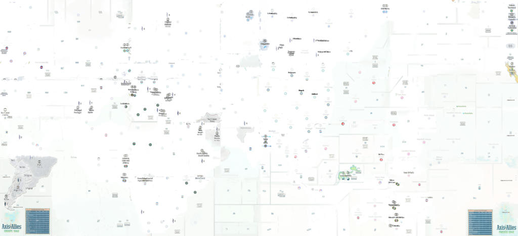
There is more, I will look into other threads where I posted on similar topic.
Here is a few others comments which you might consider before finalizing your map.
@Patchman123:
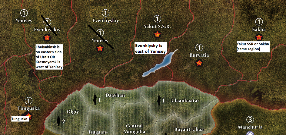
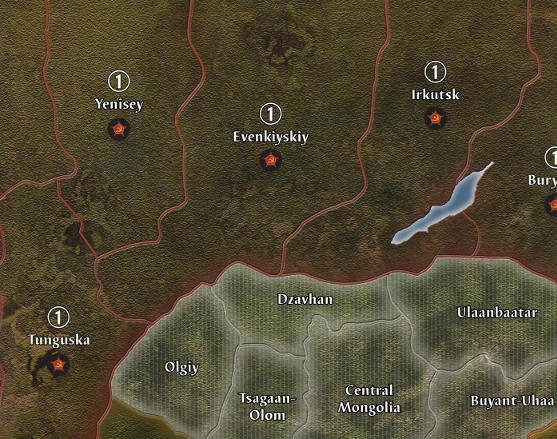
I noticed that there are inaccuracies with the eastern territories of the Soviet Union. Evenkiyskiy is the name of Evenkiy Okrug, and it really does not mean anything by itself, unless it is used with the natsionalnyy okrug. Okrug can also be used in Russian to describe American counties, such as Okrug Kroforda (Crawford County, the county in Pennsylvania where I live)
Yenisey is the name of a river and is the name of a river in Russia, but it is not a name for anything. But you’re gonna ask me, “Mississippi is the name of a river and a state, right?” Ohio is too. Yeniseysk was the name of the territory in World War I that was later abolished by the communists in their bid to reform Russian territories. Mississippi and Ohio are used officially to describe these states and rivers. Ashtabula County comes from a Native American name.
Yakut S.S.R. was never an SSR (or Soviet Socialist Republic) because it was never granted the status of a Soviet Socialist Republic (SSR) the way that the Kazakh SSR was or Estonian SSR. It was an ASSR, or Autonomous Soviet Socialist Republic, like the Crimean ASSR, which was merged with the Ukrainian SSR in 1954, and again in 2014, Russia annexed the Crimea and “reunited” it with Russia. ASSR is one step below an SSR.
Oh an Imperious leader, the “skiy” suffix is used in Pacific 1940, on the EvenkiySKIY territory on the map. Is this an incorrect non-English name that I see?
Yakut S.S.R. should be renamed Irkutsk (or Irkutskaya Oblast) because it is exactly where Irkutsk would be on a map of Russia.
Sakha is just another name for Yakut SSR, which the native Sakha language name for the territory in question, just like how Ohio from a Native American name or that Erie, Pennsylvania is from the Erie language and is also the name of the county surrounding it.
Are you gonna say that Saegertown is not on your map, either? Saegertown does exist and it not on very many maps due to its small size, but it is there. I go to their library to exploit their free interlibrary loan from the State of Pennsylvania, which they do not charge, compared to Meadville, which keeps ripping me off for $1.00 that pay for a book that does not come in.
Buryatia is the modern Russian name of that territory and from 1923-1958, it was called the Buryat-Mongol ASSR.
Timguska should be spelled Tunguska and again, Tunguska is the name of the river. I think that Timguska should be renamed Altay Kray (Altayskiy Kray) because that is the territory that it appears to be filling in for on that map.
On another note, wouldn’t it be ridiculous to have a map where Ohio is called “Keystone State?” and Pennsylvania is called as well, Pennsylvania on the right territory of Pennsylvania. Sakha and Yakut SSR are both the SAME names for the same territory.
I have no idea why the Eastern Soviet Union was not redesigned in their efforts to promote a better Axis & Allies.
I think that Yenisey should be renamed Krasnoyarsk because the territory called Yenisey on the map appears to encompass most of Krasnoyarsk Kray (Kranoyarskiy Kray) or Krasnoyarsk Territory.
Guam does not even use its correct geographical shape.
Neither does Okinawa. These islands appear to be just genetic dots on the map, just a lump of nothing.
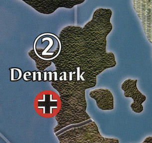
The Northeast part of Korea appears to occupy the entire southeastern part of the Soviet Union.
The Mekong delta is occupied by Siam, when it should go to French Indo China.
The Dutch insignia used on the game board is incorrect because the one used on Sumatra, Celebes, Java, and Dutch New Guinea and on Suriname was changed in October 1939 so that the Dutch planes would not be confused with British planes or French planes because of the similarities of the insignias.
The Dutch changed their markings to an orange triangle outlined in black in October, 1939, which was 8 months before this game takes place in June 1940.
If this game takes place in 1940, then how come it uses the 1939 Dutch insignia?
The original game’s (historically inaccurate) Dutch insignia used in the game. This insignia was abolished in October 1939. The Dutch Forces in the East Indies also used the orange triangle because it was the standard Dutch insignia for all Dutch forces.
The geographical shape for the Philippines is correct, but Midway is not.
The rest of the Aleutian Islands appear to be missing from the map.
Here’s what the Aleutian Islands looks like.
As you can, the rest of the Aleutian Islands are absent from the rest of the map.
The Solomon Islands belonged to Britain, not ANZAC/Australia/New Zealand, as depicted in the game.
Honolulu is on the wrong island.
The Gilbert Islands ACTUALLY looked like this.
If you please, I would like to see the correct geographical outlines used for the various islands on the map, such as Malta, Okinawa, Gilbert Islands, Guam, and Palau Islands.
Malta looks like this.
I do not want, nor need Gozo or the other third island to be depicted, just Malta.
Sicily, Sardinia, and Corsica use their correct geographical silhouettes/outlines.
All these islands look like tiny dots on a map that do not use their correct geographical outlines.
The Mariana Islands looked like this.
Johnston Island looks like this on a REAL map.
The Line Islands look like this.
New Hebrides ACTUALLY look like this.
Europe 1940 map has incorrect geographical shape of Malta.
I am sorry that I was unable to show photos of the different islands because I am not allowed to post links on here.

