@Azimuth yeah, I understand the challenge, I’m a graphic designer and I was playing around with a circular map design when I stumbled upon yours. I still might finish my design as I was incorporating some map changes I found interesting. But so far I think I’ll need some blow up boxes or something to make it work at a reasonable size.
Tjoek's A&A 1914 OOB Map file (Updated February 9th 2020)
-
As far as I’m aware the map is finished! Finally!
Please review the full size map at this
linkand give any feedback. I will go over it once more myself in a couple of days before releasing the map as final. -
@Tjoek Absolutely…Wow! You did an amazing job on the color capture and with the roundels. The map looks so much better without the gray port symbols on the board too, and of course, the cleaned up Sahara area. I compared your map to my game board and really am not finding anything to add or critique. For some reason my zoom of the map the further I go in somewhat distorts the names on the board, but as long as they are clear and crisp when printing out, I think the map looks great.
Do you think the final map will print out well around 48x48 in size and keep the detail?
-
@The-Plastic-Commando
You should be fine with a 48 inch print, but don’t print this file yet. There is still a mistake near Rome. The city marker is partly overlapping the Italian roundel, but this overlapping bit of the city marker is still in the old colors before I enhanced them. I forgot to include that layer when I enhanced the colors…Did you notice the two roundels that are different then the original board design? :-)
-
@The-Plastic-Commando said in Tjoek's A&A 1914 OOB Map file:
For some reason my zoom of the map the further I go in somewhat distorts the names on the board, but as long as they are clear and crisp when printing out
If you zoom in to the level you can tell the individual pixels apart it will look a bit distorted. But you will not see this when you print the map as this will nowhere near this level of zoom. Unless you print a map over 86x86 inch or something. And who will ever do that?
-
It takes a while for the image to clear, that’s a function of your computers memory processing power.
I like what i see, but i still like my file better because all the artwork is VECTOR BASED and not an image or scan of an image. Don’t like the OOB sea color or lines either but that’s subjective
-
@Tjoek Well now that you mention it, Holland looks a bit different with the crest in the roundel. I’m not noticing a second roundel different lol
-
@The-Plastic-Commando said in Tjoek's A&A 1914 OOB Map file:
@Tjoek Well now that you mention it, Holland looks a bit different with the crest in the roundel. I’m not noticing a second roundel different lol
1.) Holland has a different crest I took from the official royal standard from that time. The blue shield in the middle of it is actually the same as in the original artwork.
2.) Persia has a slightly different roundel as well. The red is less strong and the lion is smaller. According to the internet (wikipedia) this is the right flag from that era. The one HBG has for sale has a larger lion and stronger red, but that flag is from a few decades earlier.
-
@Imperious-Leader said in Tjoek's A&A 1914 OOB Map file:
I like what i see, but i still like my file better because all the artwork is VECTOR BASED and not an image or scan of an image. Don’t like the OOB sea color or lines either but that’s subjective
Thanks IL, everyone their own preferences. Vector images do have the advantage of scaling indefinitely and still be crisp and clear but they often lack the depth of texture and dynamic colors that I personally find far more pleasing to the eye. And in my experience you don’t need that scalability when you print your maps for decent gaming tables. Unless off-course you want a wall-size carpet hanging in your gaming room ;-)
-
@Tjoek 👍
-
@Tjoek :+1:
-
Just another question to you guys:
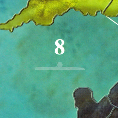
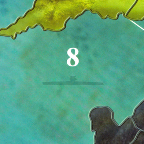
The Germans have the ability to declare “Unrestricted Submarine Warfare” which means that their subs in sea zones 2, 7, 8 have the ability to raid US and UK convoys. I could mark those sea zones on the map with a semi transparent icon of a sub as a reminder that these 3 sea zones are affected.What are your thoughts on this?
Update on the map
Besides I have spotted a few minor mistakes and small things I want to revisit on the map. Nothing big, but some text not being as white as it could be, some better centering of territory names and fix some text deformation that happened during stitching of individual scans: For examples the M in Mesopotamia had a small kind of wiggle in it.Expect an updated map somewhere this week.
-
@Tjoek Hey Tjoek, I kind of like the sea zones without a submarine icon. It stays true to the other zones of the map without icons. 😊
-
@Tjoek Since I use my own houserules with more historical USW zones, I dont really need the icons on the map. But I am interested in how they look for sure. Maybe you´ll have one strict oob map and another one with some upgrades… Can´t wait for the next update!!
-
Just for your info, the sub icon as just tried is a silhouette of the actual sub miniature from the game itself. First I thought about a semi transparent icon in white, but a dark icon looks nice as well :


Not too busy or bold, just a slight reminder of the rule and the sea zones affected. The more I look at them, the more I prefer the dark icon as if there is a sub submerged :-)
Any comments are appreciated!
-
@Tjoek Actually that looks pretty good, the darker silhouette. 👍
-
@Tjoek I also like the darker silhouette.
-M_R
-
@Tjoek definitly the dark one
-
The map file is released!
One version without and one version with the harbours. I opted to not include the submarine icons on the map by default, but I’ve added the dark transparent silhouette as well as the Mobilization Zone as separate files you can simply overlay yourself.
Enjoy and please share pictures of your map if you happen to print one of this files.
If you have any questions or need support feel free to send me a PM or post it here.
-
@Tjoek outstanding work!! Many thanks for releasing the map file. I have waited for this to happen since 2013 :-D
It will take some time but I promise to share pictures of the printed map . Again, thank you very much Tjoek!
-
@Tjoek Awesome! So where do I go to view the finished map and download? Can’t wait to see.


